Calanques Hike and More of Cassis
If you read my morning post from this, my day trip to Cassis, you’ll know that I’d been hoping to take a boat tour of the Calanques, but I couldn’t because the tours weren’t running due to rough seas. You’ll also know that a guy in the tourism office said the Calanques aren’t far and he recommended a hike to the closest one, Calanque de Port-Miou, which can be reached mostly by city roads. He also suggested hiking the trail from there to the next Calanque over, Calanque de Port Pin as it’s more scenic and makes for a great picnic spot.
He handed me the map on which he’d been marking the Calanques and the routes and recommended a bakery where I could buy a sandwich for my picnic.
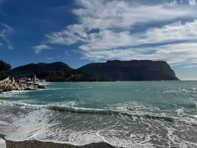
I took his advice and his map and set off.
One thing you might not know, because I didn’t mention it in this morning’s post (although I have a vague, possibly flawed, recollection of having mentioned it elsewhere in these pages is that I’m useless with paper maps. Absolutely. Totally. Useless.
Smartphones, and particularly their mapping apps, are a godsend for tourists. I didn’t do as much travelling before their arrival. There are a few reasons for that. For one, I was working then (I’m retired now), so I didn’t have as much time for travel. For another, I was less financially comfortable then, and for some unknown reason, travel costs money. And for a third, I regularly got lost when I travelled.
To be honest, I enjoy getting lost occasionally. It allows me to explore a city and taste more of its flavour than I would if I always only walk purposefully to preselected destinations with a screen blinder on.
But I don’t enjoy getting lost all of the time. There are always some specific sights that I very much want to see. That’s possible only if I can find them. And, at the end of the day, I have to find my way back to my hotel. Those things always challenged me when I had to rely on paper maps.
I tell you this as an introduction to saying that to get to Calanque de Port-Miou, I found it on Google Maps rather than relying on the paper map the tourism guy gave me. But a Calanque is basically an inlet of water with rock walls. It’s not a single point that Google Maps is willing to plot a walking route to.
So I found something with “Calanque” in the name on Google Maps that was close to Calanque de Port-Miou, and, based on the name, looked like it was the entrance to the Calanques Park. I had Google Maps plot a route there.
(I wasn’t worried about getting from Calanque de Port-Miou to Calanque de Port Pin because the guy in the tourism office said there is only one trail between the two and it’s marked.)
With that route in hand, I began my trek.
Journey to Calanque de Port-Miou
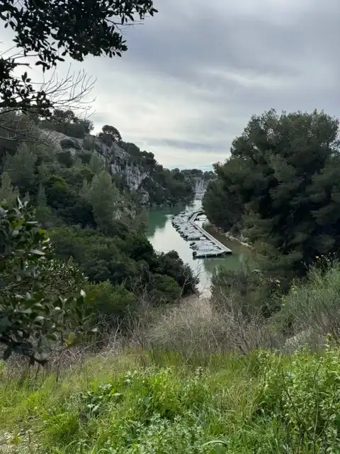
I followed the route Google Maps gave me, and walked a little past the point I’d selected. I could see a part of the Calanque down there, but I didn’t have much of a view of it. Nor could I see a path to it or to a viewing point.
There was a bit of open ground beside the road, so I stood there and pulled out the paper map. Looking at it and comparing it to Google Maps to make sure I had the orientation correct, I saw that the tourism office guy had marked a spot for me on the other side of the Calanque.
As I was looking at the paper map and Google Maps to try to figure out how to get there, a young couple approached me. The woman asked me a question in French. I recognized enough words to believe, with a reasonable degree of certainty, that she was asking me how to get to the Calanque.
I asked her, “Parlez-vous anglais?” I have no idea why I asked her in French. If I’d instead asked her, “Do you speak English?” and I got a blank stare in return, I’d have my answer.
In response, she turned to the guy she was with and asked him, in French, to speak to me in English. He did.
They were, indeed, asking me if I knew how to get to the Calanque. I would have thought that the facts that I was staring at one paper map and one online map, and that I didn’t speak French, the local language, should have given them a strong clue that I might not be the right person to ask.
I told him, “No. Sorry. I’m looking for the same thing.”
While we were trying to puzzle it out, a man walked by. The woman of the couple asked him if he knew how to get to the Calanque.
He did. I caught the words “gauche” (left), “maison” house, and a few other words that I recognized and knew but have since forgotten. I was able to piece together what he said. The young man translated it for me. I didn’t stop him because I wasn’t sure that I got it right. But I did.
We had to walk to the house on the road back the way I came, and then turn left and go down a trail.
The couple set off first, and I followed behind them. I saw that the path was exactly where Google Maps sent me to.
The reason I didn’t notice the path before was that it’s right beside the house, narrow, and barely a trail. Its surface is a bunch of rocks, stones, and earth that didn’t look like it had seen much grooming. When I got back to it, I saw that it was indeed marked as a Calanques trail. But the label was narrow and vertically oriented on a small post. And the marker was placed on the side of the post that I couldn’t see from the direction I came when walking from Cassis, only when I walked back to it. I checked. There wasn’t another one on the other side.
The rough, treacherous trail was down a steep hill. I was glad that the young couple were a fair distance ahead of me at that point. I wouldn’t have wanted them to hear the curses I was softly muttering. Then again, likely only the man would have understood them.
At the bottom of the hill, the trail met up with a perfectly paved road. I made a mental note to check on the way back if I could take that road rather than the trail back to Cassis. (It’s much easier to use Google or Apple Maps in that direction because there are lots of places in town to plug in as destinations. Spoiler: That road does lead right into town.)
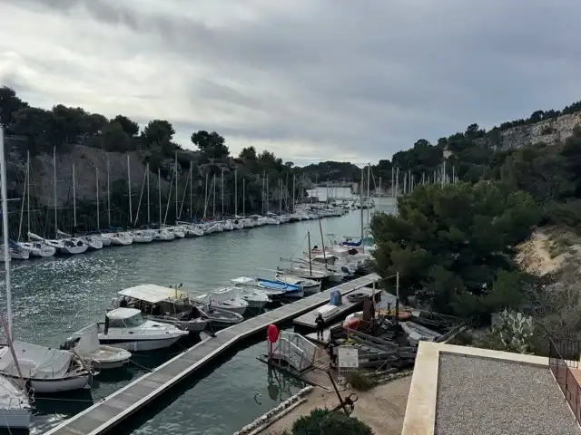
And with that, I was right beside and above Calanque de Port-Miou. It’s a very beautiful spot, but a little too on the civilized side. The sides of the Calanque are rugged rock, but it’s a wide enough cove that there is a boat club there and lots of small craft anchored in it. That makes for a very pretty picture, but it’s not the rugged nature I was expecting.
Journey to Calanque de Port Pin
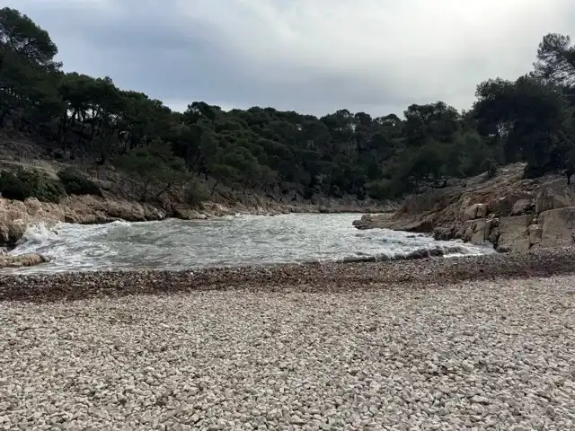
The path along the plateau above Calanque de Port-Miou to the trail to Calanque de Port Pin was interesting. The ground there consists of tan-coloured, fine-grained, tightly compressed gravel that seemed quite water-impermeable.
An obviously manufactured path made of the same material rose perhaps a half a metre above the natural surface of the ground. At first, I didn’t understand why the raised path was there. I walked along the lower level.
It wasn’t long before I came upon some large puddles that would have been impassible without getting a major soaker. (Is “soaker” just a Toronto term from my childhood? There used to be ditches in my neighbourhood. They’d occasionally fill with water, especially in the spring thaw. If you unintentionally or otherwise stepped into them, possibly on ice that wasn’t thick enough to hold your weight, and got a shoe-full or a boot-full of water, that was called a soaker.)
When I got to the puddles, I scampered up the raised path and walked along it.
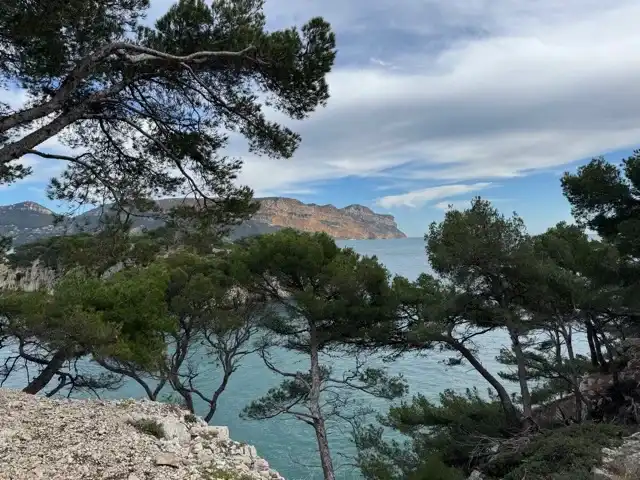
That raised path ended by the time I reached the trail to Calanque de Port Pin. I won’t describe every step of that trail except to say that there were points where I desperately wished for some other people to come along so they could let someone know where my body was lying. There were some steepish hills, with only rough rocks that didn’t all have good footholds.
I’m better on those sorts of trails going up them than going down. I’m never worried about falling up, but I’m often convinced that I’m about to die from falling down. On the way out to Calanque de Port Pin, there was both a climb up like that and a climb down, meaning that I’d have both on the way back too.
On the rugged uphill climb on the way out, I spent my time thinking, “Oh, crap! How the heck am I going to get back without dying?” On the rugged descent on the way out, I spent my time thinking, “Oh, crap! How am I going to get to Calanque de Port Pin without dying?”
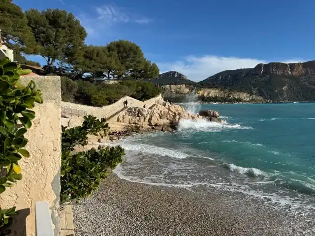
And on both the up and down rugged hills, I spent much longer than even an anemic garden slug would take to traverse them because I carefully analyzed every possible footfall for the choice that looked safest. And then I gingerly, oh so gingerly, moved my feet to try to slowly land on those footfalls.
Spoiler: I didn’t die on the way to Calanque de Port Pin or on the way back to Cassis.
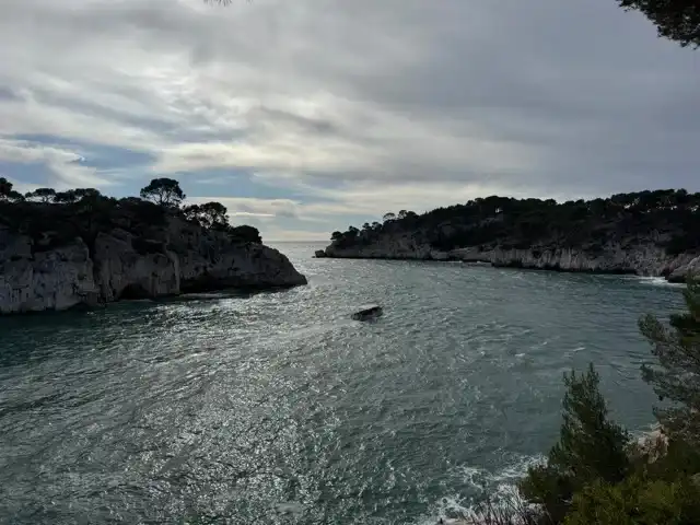
Calanque de Port Pin is indeed very pretty. Its walls are rugged, but not high. And they’re tree-covered. There is a small beach. You can get right up to the water, and in it if you like.
For some unknown reason, there’s a small stone wall behind the beach, with some steps up to it. People were using those as seats to have their picnic on.
Off to the side of the beach, someone had placed a lot of stumps of wood sawn from a wide-trunk tree or trees, with one of the flat sides facing up. They made good stools. I sat on one while eating my sandwich.
I spent some time enjoying Calanque de Port Pin and then headed back the way I came, except instead of that treacherous trail near Calanque de Port-Miou, I took the civilized road.
Back in Cassis
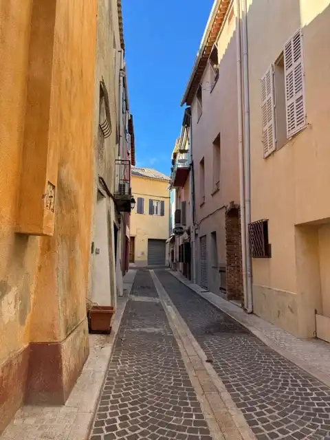
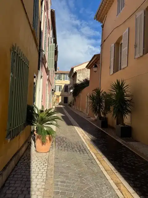
When back in Cassis, I wandered the internal streets back from the port for a while. They are residential roads with almost no cars and very charming, low-rise homes. I could easily imagine myself spending some time in Cassis someday if I weren’t so darned old and had other places I’d still like to see and places I have seen and would like to revisit, like Cassis now, for example.
After my strenuous and at times hair-raising afternoon, I decided I deserved a gelato to reward myself. The gelato shop I found is close to the public square, so I walked back there with my gelato, sat down, and relished it.
After that, I walked over to the tourism office to ask how one pays for the bus. You can just tap on your credit card.
Then I looked at Google to confirm where the bus stop is (the guy told me, but you know me and directions) and to check on the bus schedule. The bus from town to the station isn’t frequent. There was one in half an hour and another one in a little over an hour.
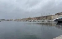
I made a life-affirming decision that I had not rewarded myself nearly enough for surviving the arduous hike. So to augment my reward, I went to a restaurant by the port, sat at an outside table facing the water, and enjoyed a glass of wine and the view.
With that reward accepted, I went to the bus stop and headed back to Marseille.
Discover more from Joel's Journeys & Jaunts
Subscribe to get the latest posts sent to your email.

Well, that was an intrepid and ultimately rewarding adventure. We did know the outcome from the fact that we are reading this post, but not the twists and turns and ups and downs of it. So lovely it looked, and such a nice day for it. Bravo!
I find it so hard when writing in the first person to maintain the suspense of whether I die in the midst of the tale.
I’m glad it came off as a nice day in my pictures and prose because it was a good day.
The ups and downs of those coastal paths. Camaraderie (with fellow disoriented hikers) at the calanques de Cassis. That picnic on the beach, perched on a convenient stump. Well done. I learned that “cassis” means blackcurrant, thank you very much.
It was a great day. And you’re welcome very much.